Worldwide, Indigenous people and local communities (IPs&LCs) collectively manage more than half of the world’s land. These lands, which include a large proportion of the world’s remaining intact forest ecosystems, are vital not only to those who inhabit them, but also to the rest of the world as biodiversity hotspots, their ability to filter pollutants from air and water, and their role as carbon sinks. Unfortunately, many of these areas, including the livelihoods of those who inhabit them, are under enormous pressure from land grabs and other encroachments, deforestation, and climate change. Despite strong evidence that granting land rights to IPs&LCs is one of the most effective ways of mitigating these threats, it is estimated that IPs&LC land rights are formally recognized within only a fraction of these areas. Documenting where and how IPs&LCs use their land, specifically through mapping, is an important step toward ensuring their rightful ownership and protection.
Indigenous people have been using maps since time out of mind, albeit often in forms that differ from the conventional maps we are familiar with today. These early maps served many purposes, including navigation, resource management, storytelling, and cultural preservation. The Navajo and Anasazi peoples of North America created rock art featuring maps, the Aboriginal Australians used bark maps to represent their ancestral lands, and the Inca Empire of South America used quipu, a system of knotted strings, to record and convey information about their territories.
More recently, advancements in mapping technologies have led to tremendous improvements in the availability, functionality, and accessibility of tools that enable IPs&LCs to document their lands more effectively than ever before. In the 1990s, improvements in desktop computing—specifically in memory size and graphics capabilities—increased the availability of software and spatial information. These advancements provided many IPs&LCs with access to tools, like Geographic Information Systems (GIS), that could be used to create, analyze, and share digital maps. Many IPs&LCs began developing inventories of geospatial information that were used to plan and manage cultural, environmental, and ecological values within their territories.
In the 2000s, further advancements, including the availability of digital cameras and handheld GPS devices, enabled IPs&LCs to monitor their lands more effectively by allowing for the tracking, documentation, and incorporation of this information into GIS. Additional mapping technologies such as drones, open-source software, and artificial intelligence hold the promise of further enabling IPs&LCs to document their lands.
However, despite mapping technologies being more capable and accessible than ever, there is no one-size-fits-all approach, and many IPs&LCs worldwide continue to face significant challenges in acquiring, customizing, and utilizing these technologies. The technology landscape is extensive, posing challenges for IPs&LCs in selecting the most suitable tools and integrating them with existing systems and workflows while also addressing security and privacy concerns. Many IPs&LCs lack the financial resources to invest in mapping technologies, including purchasing hardware, software, and training needed to use them. In remote or underserved areas, access to reliable internet connectivity can be limited, making it challenging to utilize and update mapping technologies effectively. Furthermore, building and customizing technologies to meet the needs of IPs&LCs often requires specialized technical skills, and many IPs&LCs may not have individuals with the expertise needed to implement and maintain these technologies.
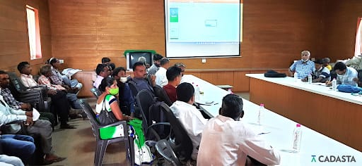
Addressing these challenges often requires collaboration with external organizations, government agencies, and NGOs to provide the needed resources, training, and technical support. The following two case studies provide examples of how two IPs&LCs, from different parts of the world, collaborated with partners to map their resources and address these challenges together.
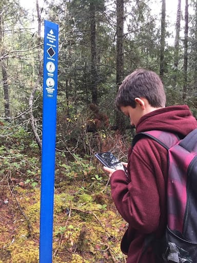
T’Sou-ke First Nation, of the Coast Salish peoples, is a sovereign Indigenous nation whose community and traditional territory encompasses the basin surrounding Sooke Harbour at the southern end of Vancouver Island in British Columbia, Canada. T’Sou-ke’s territory contains an abundance of cultural and ecological values, the documentation of which is critical to supporting T’Sou-ke in their efforts to assert land and resource rights within their territory. To support this effort, the nation developed a field data collection system to record observed values and augment and verify the accuracy of its parallel mapping efforts.
Based on the Open Data Kit (ODK) platform, the system required significant customization to meet T’Sou-ke requirements. The nation hired a contracted GIS professional to perform this task as the capacity to do so was not available internally. Setup, deployment, and training took several months, with careful consideration given to the need to incorporate the collected data into existing GIS and information management systems that met the nation’s data security and privacy criteria. In order to understand the community’s desired outputs and objectives, the collaboration required a significant level of trust and listening to tailor the solution to meet the community’s specific needs. Additionally, training and ongoing technical support was provided to the Nation to continue the work with less outside support.